Back

N°64 - Le Haut Forez - Espace VTT-FFC Massif des Bois Noirs

La Chamba
__altimax_map_fiche-marker-5593497
Leaflet © OpenStreetMap contributors © CARTO
051015202530km7008009001,0001,1001,200mAltitude
I'm going

Technical informations

  • Distance 32km
  • Difficulty Hard
  • Type of itinerary Loop
  • Ascent 920m
  • Negative gradient n/c
  • Daily duration 05h00
  • Itinéraire balisé BALISE
  • Nature du terrain Stone, Ground
  • Altitude moyenne 900m
  • Altitude maximum 1260m

Equipements

  • Cycling sports
  • Mountain biking itinerary

Type of clientele

  • Mountain bikers
  • Level red – hard
Information
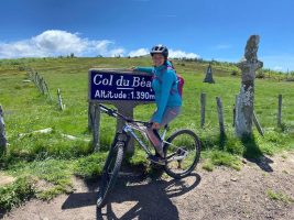
N°64 - Le Haut Forez - Espace VTT-FFC Massif des Bois Noirs Col de la Loge coté Col du Béal à gauche de la piste 42440 La Chamba