


Technical informations
-
Distance 48.3km
-
Difficulty Hard
-
Type of itinerary Loop
-
Ascent 1260m
-
Negative gradient n/c
-
Daily duration 05h30
-
Itinéraire balisé BALISE
-
Nature du terrain Rock, Stone
-
Altitude moyenne 1400m
-
Altitude maximum 1634m
Equipements
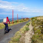
- Cycling sports
- Mountain biking itinerary
- Routes for electrically assisted cycles
Type of clientele
- Mountain bikers
- Level red – hard
- Level black - very hard